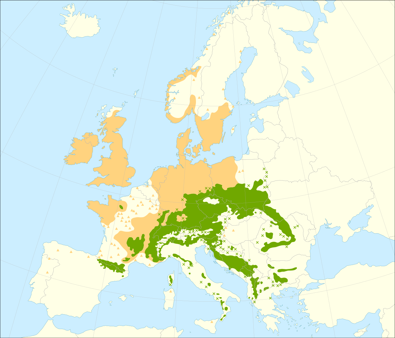
Abies Alba distribution map from Wikimedia
The Species Distribution maps depict distribution ranges of 45 European tree species. The dataset is composed of numerous species distribution maps available in geographical information system (GIS) format, created by compiling, evaluating and synthesizing data collected from 20th century atlas monographs. The geometry of the individual datasets describes contiguous large areas of occupancy of each species as polygons and fragmented or isolated occurrences as points.
Since this geodatabase is intended to provide a synthetic continental-scale overview of the species ranges, the maps represent the species’ general chorology and the presence/absence information should not be considered absolute in terms of geolocation.
An accompanying text document is included with the data, which provides more details on methodology and a list of all mapped species with related file names, taxonomical delimitation of the mapped species and references used to compile the respective chorological dataset.
Example of usage integration on EUFORGEN website, Abies Alba species page.
Domain and Species
FOREST-
Organisation
Joint Research Centre (JRC) Authors/Editors
Giovanni Caudullo, Erik Welk, Jesús San-miguel-ayanz- Created on: 01/02/2021
- Go to the website
Year:
2020Languages:
EnglishType
MapTags
Biodiversity Forest Conservation Unit Species distribution map Distribution European trees
